Showing posts with label Peaks. Show all posts

Sunday, January 19, 2020

Sengottaraayar Peak, Coonoor, Nilgiris

Sengottaraayar Peak, Coonoor, Nilgiris
Sengottaraayar Peak is situated right on the Border of Tamil Nadu and Kerala and overlooks the Palakkad Silent valley on the south in the distance and Mukurthi National Park on the West. This peak is about 1800 meters high. This Peak is known for its trekking and beautiful terrain. This range is also home to number of tribal settlements including the Irula, Toda and the Badaga communities.
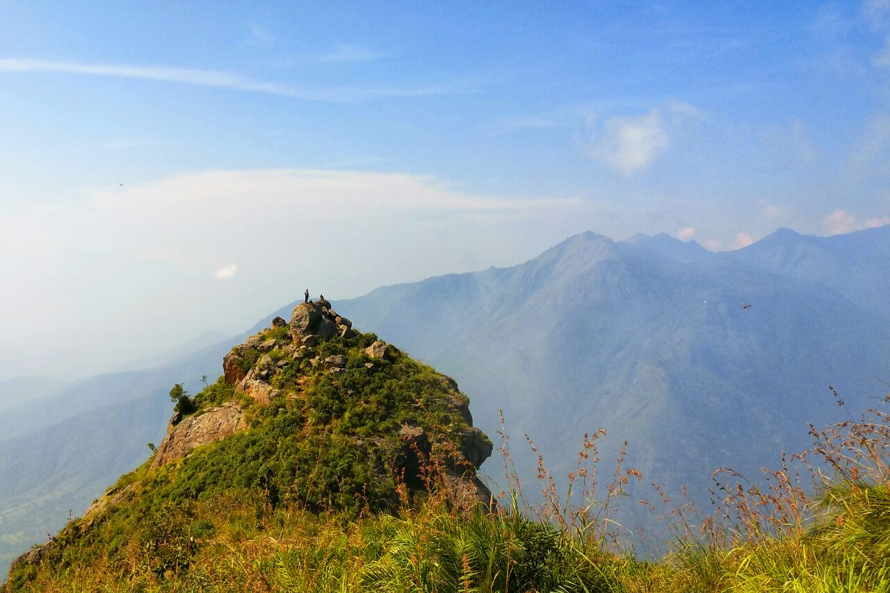


It is a lesser known peak in the Nilgiris that offer an awesome view of the Pilloor and Geddai valleys. Do take a guide or local person with you unless you know very well about the trail leading to the peak and the surroundings. It is approachable from the Kolacombai - Manjakombai road. Be cautious during rainy seasons.


The trek begins at the Irula hamlet called Mooperkaad bordering the forest. The trek to the peak takes us through mixed terrain including shola forest, tea and coffee estates. One of the features of this trek is that you will have the opportunity to spot wildlife including Gaur (Indian Bison), Barking deer, and come across plenty of signs of Sloth bears. This trek is an excellent choice for first-time trekkers, nature photographers, children and corporate teams.


Manjakombai Village is situated at about 30 Kms from Coonoor Town. From Manjakombai Village, travel for another 4 Kms to reach CSI Church Kottakkal. Park the vehicles near to this church and start the trek. The Trek is about 30 minutes through Tea Estates and Shola Forests. Manjakombai Village is located at about 24 Kms from Coonoor Railway Station, 24 Kms from Coonoor Bus Stand, 30 Kms from Coonoor, 32 Kms from Ooty, 51 Kms from Mettupalayam Railway Station, 85 Kms from Coimbatore and 90 Kms from Coimbatore Airport.


Location

Friday, March 22, 2019

Rangaswamy Peak & Pillar, Kotagiri, Nilgiris

Rangaswamy Peak & Pillar, Kotagiri, Nilgiris
Rangaswamy Peak & Pillar is situated near Kotagiri near Ooty Hill Station in Kotagiri Taluk in Nilgiris District of Tamil Nadu. Rangaswamy Peak & Pillar is one of the famous tourist spot in Kotagiri Area.


Rangaswamy Peak
Rangaswamy Peak is sacred to the Irula, Badaga and the Kurumba tribes of the Nilgiris. The height of Rangaswamy Peak is above 5,885 ft (1,794 m) and it is visible from Kodanad View Point. Rangaswamy Peak has a temple dedicated to Lord Rangaswamy, a form of Vishnu, located at the top of the Peak. There are two shrines in this Temple; One for Lord Rangaswamy and the other for his consort.


According to Hindu legends, Lord Rangaswamy used to live at Karamadai (Coimbatore District) on the plains but quarreled with his wife and came to live alone here. Two-foot prints on the rock not far at Arakadu village below the peak are believed to be evidences for this. The devotees come here mainly during the summer months, so if you want to trek alone and avoid intense heat, avoid May.


Rangaswamy Pillar
Rangaswamy Pillar is found on the north west side of Rangaswamy Peak. The height of the pillar is about 400 feet. Rangaswamy Pillar is not yet climbed due to its sacredness.


Connectivity
Rangaswamy Peak & Pillar is located at about 20 Kms from Kotagiri Bus Stand, 21 Kms from Kotagiri, 37 Kms from Coonoor, 41 Kms from Coonoor Railway Station, 50 Kms from Ooty Bus Stand, 50 Kms from Ooty Railway Station, 51 Kms from Ooty, 50 Kms from Mettupalayam Railway Station, 84 Kms from Coimbatore and 91 Kms from Coimbatore Airport. One has to take the road from Kotagiri which goes to Kodanad View Point and take a detour halfway. You can find steps for most of way up to the temple at the top of peak and for a small portion of the trek you have to go through tea estates.
Location

Doddabetta Peak, Ooty, Nilgiris

Doddabetta Peak, Ooty, Nilgiris
Doddabetta Peak is located in picturesque Nilgiris Hills near Ooty Town in Ooty Taluk of Nilgiris District of Tamilnadu. The name Doddabetta literally means ’Big Mountain' in the Badugu Language, which is so in reality. It is situated at the junction of Western and Eastern Ghats and offer beautiful vistas of Nilgiri Hills range. 


The Peak
Doddabetta is the highest peak in the Nilgiri Mountains at 2,637 metres (8,650 feet). It is the fourth highest peak in South India next to Anamudi, Meesapulimala and Mannamalai. The peaks Hecuba (2375 m), Kattadadu (2418 m) and Kulkudi (2439 m) are the three closely linked summits in the west of the Doddabetta range near to Udhagamandalam.


There is a reserved forest area around the peak. It is a popular tourist attraction with road access to the summit. One can have a magnificent panoramic view of landscape and the whole of the District and even beyond through the Telescope House run by T.T.D.C., which is an added attraction. The Sunset is spectacular from this view point. 


Flora
The area surrounding Doddabetta is mostly forested. Sholas cover the hollows of its slopes. Slightly stunted, rhododendron trees, in the midst of thick coarse grass, flowering sub-alpine shrubs and herbs are common, even very near the peak.


Telescope House
There is an observatory at the top of Doddabetta with two telescopes available for the public. It was opened on 18 June 1983 and is run by the Tamil Nadu Tourism Development Corporation (TTDC). The average number of viewers in 2001-2002 was 3500 per day in season and 700 per day in the off season.

Connectivity
Doddabetta Peak is located at about 10 Kms from Ooty Bus Stand, 11 Kms from Ooty, 10 Kms from Ooty Railway Station, 25 Kms from Coonoor, 27 Kms from Kotagiri, 56 Kms from Mettupalayam Railway Station and 95 Kms from Coimbatore Airport. Doddabetta Peak is situated on the Ooty-Kotagiri Road. Private Taxis are available from Ooty, Kotagiri and Coonoor to reach this place.
Location

Saturday, February 9, 2019

Mukurthi Peak, Ooty, Nilgiris

Mukurthi Peak, Ooty, Nilgiris
Mukurthi Peak is located in picturesque Nilgiris Hills near Ooty Town in Ooty Taluk of Nilgiris District of Tamilnadu. Mukurthi Peak is the one of the highest peaks in the Western Ghats of Tamil Nadu, India, and fourth highest peak in the Nilgiri Hills. It stands at an altitude of 2,554m (8,379ft). It is situated in the border of Udhagamandalam taluk, Nilgiris, Tamil Nadu and Nilambur taluk, Malappuram District, Kerala. Mukurthi peak resembles to "Pointed Nose". It is a part of Mukurthi National Park (Nilgiri Tahr National Park), Nilgiri Biosphere Reserve.


Mukurthi hill is covered with shola forest including pine, grasslands and shrublands. It is a favorable place for Asian elephant, Tiger and rare endemic to Nilgiri Tahr. Mukurthi National Park (peak) sandwiched between Mudumalai National Park and Silent Valley National Park. It is one of the best trekking place and tourist spot in Ooty. Pichalbetta (2,544m) and Nilgiri hill are the prominent peaks adjacent to these area. Mukurthi dam (lake) is also nearby.


Mukurthi Peak is located at about 26 Kms from Pykara, 42 Kms from Gudalur, 47 Kms from Ooty Bus Stand, 48 Kms from Ooty, 47 Kms from Ooty Railway Station, 66 Kms from Coonoor, 76 Kms from Kotagiri, 97 Kms from Mettupalayam Railway Station and 142 Kms from Coimbatore Airport. Private Taxis are available from Ooty and Coonoor to reach this place.


Location