Virudhunagar – General Information
Virudhunagar
District is an administrative district of Tamilnadu State in southern India. Virudhunagar is the district headquarters. Virudhunagar
district was formed by the separation of Old Ramanathapuram District on 1987
into Ramanathapuram District, Sivagangai District and the west part as
Virudhunagar District. Virudhunagar District was formerly called Karmavirer
Kamarajar District. As of 2011, Virudhunagar district had a population of
1,942,288 with a sex-ratio of 1,007 females for every 1,000 males. Virudhunagar
District occupies an area of 4288 km².

It is
bounded by Madurai District on the north, Sivaganga District on the northeast,
Ramanathapuram District on the southeast, Thoothukudi District to the south,
Tirunelveli District to the southwest, Kerala state to the west, and Theni
District to the northwest. The Head-Quarters of the district Virudhunagar is
located at the latitude of 9N36 and 77E58 longitude. Contrary to the popular
saying, that 'Virudhunagar produces nothing, but controls everything',
Virudhunagar does produce a variety of things ranging from edible oil to
plastic-wares. Sivakasi known as 'Little Japan' for its bustling activities in
the cracker industry is located in this district.

Virudhunagar
was a part of Tirunelveli district before 1910, after which it became a part of
Ramanathapuram district. After being grafted out as a separate district during
1985, today it has eight taluks under its wings namely Aruppukkottai,
Kariapatti, Rajapalayam, Sattur, Sivakasi, Srivilliputtur, Thiruchuli and
Virudhunagar. Virudhunagar, formerly known as Virudhupatti, is a town and
the administrative headquarters of the Virudhunagar district in the South
Indian state of Tamilnadu.

It is
located 506 km (314 mi) southwest of the state capital Chennai and 53 km (33 mi) south of Madurai. Virudhunagar emerged as an important trade centre
during the British rule. The town is the birthplace of freedom fighter K.
Kamaraj, former chief minister of
Tamilnadu, and Bharat Ratna recipient.
Located to the east of Kowsika
River, Virudhunagar has an
average elevation of 102 m (335 ft.) above sea level and is largely
flat with no major geological formations. The town has a humid climate and
receives 780 mm (31 in) rainfall annually.

History
For
brief details, please refer below link;
Demographics
According
to 2011 census, Virudhunagar district had a population of
1,942,288, up from 1,751,301 in 2001, or about an 11% increase. The
sex-ratio was 1,007 females for every 1,000 males, much above the national
average of 929, but down from 1,012 in 2001. A total of 197,134 were
under the age of six, constituting 100,827 males and 96,307 females. Scheduled Castes and Scheduled
Tribes accounted for 20.59%
and .12% of the population respectively. The average literacy of the district
was 72.02%, compared to the national average of 72.99%. The district had a
total of 537,748 households. There were a total of 950,158 workers, comprising
52,361 cultivators, 168,174 main agricultural labourers, 30,292 in house hold
industries, 603,239 other workers, 96,092 marginal workers, 4,792 marginal
cultivators, 40,528 marginal agricultural labourers, 5,006 marginal workers in
household industries and 45,766 other marginal workers.
Administration
The
district is divided into two revenue divisions - Sivakasi and Aruppukkottai. The
district comprises nine taluks: Aruppukkottai, Kariapatti, Rajapalayam, Sattur, Sivakasi, Srivilliputhur, Thiruchuli, Vembakkottai and Virudhunagar. Totally there are 600 revenue villages in this
district. This district has nine Town Panchayats - Seithur, Vathirairuppu, Chettiarpatti,
Kariapatti, Mamsapuram, Sundarapandiam, Mallankinaru, S.Kodikulam and W.Pudupatti.
The Parliamentary Constituency number of Virudhunagar District is 34.
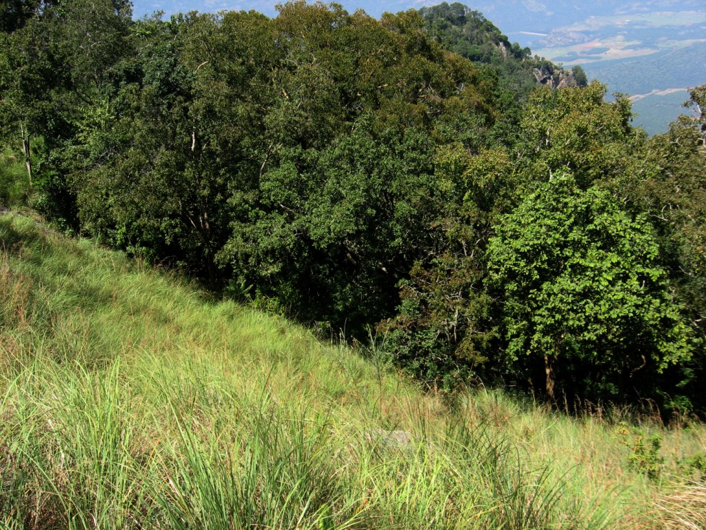
Forest
The
forests are found on the eastern slopes of the Western Ghats. Only 6.3% of the
total geographical area of the district is under forests. Many rare and endemic
varieties of flora and fauna are found along the mountain slopes. A wildlife sanctuary
spread over 480 sq. kms was established in 1989 at Shenbagathoppu in
Srivilliputtur taluk. This sanctuary is contiguous with the Periyar tiger
reserve on the south-western side and the Megamalai reserve forest on the
north-western side. The altitude varies from 100m to 2010 m above sea level.
The sanctuary is home to the endangered, arboreal grizzled giant squirrel
Ratufa macrora. The home range of an individual is between 0.197 hectares and
0.611 hectares.


The
sanctuary also hosts a variety of birds, mammals, reptiles and butterflies.
Resident and migratory elephants are common. Other animals sighted are tiger,
leopard, Nilgiri tahr, (Hemitragus Hylocrius) Spotted Deer, Barking Deer,
Sambar, Wild Boar, Porcupine, Nilgiri langur, Lion-tailed macaque, common
langur, slender loris, bonnet macaque, sloth bear and flying squirrel. Over 100
species of birds have been identified. The rare Great Indian horn bill is also
found.

Special
steps have been taken to conserve the forest areas in the sanctuary. The annual
leases given for the collection of fruit and other minor forest produce has
been stopped. Fruit bearing trees and other trees have been planted. This will
increase the food sources as well as ensure continuity in the canopy. Soil
conservation and water harvesting measures have been undertaken to improve the
habitat. The best time to visit the sanctuary is throughout the year except for
the months of March, April and May.

The
forests of Alagarkoil valley in Srivilliputtur taluk and Sathuragiri are known
for rare medicinal plants. The medicinal value of 275 plants has been recorded
and reported. The forests host a rich variety of orchids and ferns.
Economy
Virudhunagar
district is leading in the country in the match industry, fireworks and printing, mostly concentrated in and around Sivakasi. Virudhunagar is the main market for oil, chicory, coffee seeds, dry chillies and pulses. There
are two trade centres (Godowns) in the District one in Virudhunagar and another
in Rajapalayam. Ginning factories, spinning mills, power loom and hand loom
industries are also present in the district at Rajapalayam the second big
weaving town in the state after Coimbatore. One of the cement plants of Madras
Cements Ltd is located in RR Nagar near Virudhunagar another one located at
Alankulam of Sivakasi Taluk.

Virudhunagar
is a marketing and service town for the surrounding areas. As the administrative
headquarters of the district, the economy of the town is based on the service
sector, with 93 per cent of the workforce employed there as of 2001. The rest
of the workforce is employed in agriculture, mining, quarrying, raising
livestock, manufacturing, construction, trade and commerce. In 2001, 5.4 per
cent of the workforce was employed in the industrial sector, making it the
second-largest sector. There is little agricultural activity in the town on
account of weather and irrigation facilities, and the town has a set of oil
mills and match factories within the town limits. The major commercial
activities are concentrated around Katchery Road, Pullalakottai Road and the
main bazaar. In 2001, the percentage of the workforce in the service sector
had increased from the previous decade.

The agricultural output of the town is
limited because the local geography and unfavorable climate for growing
crops. All major nationalized banks like State Bank of India, Indian
Bank, Central Bank of India, Punjab National Bank, Indian Overseas Bank, and private banks like ICICI
Bank, City
Union Bank and Axis Bank have
branches in Virudhunagar. All of these banks have ATMs located in various parts of the town. Virudhunagar
is famous for Commission Marketing's of all Kinds of Millets, Cotton, and
Edible Oils.
Places of
Interest
For
brief details, please refer below link;
Hotels
List
For
brief details, please refer below link;
Connectivity
For
brief details, please refer below link;
